

When it comes to navigating, whether it be rivers or oceans you can never have too many back ups. The C-MAP navigation app now brings navigation to the palm of your hand with their easy to use app. Read on as we take a look at some of the app’s key features.
What’s New With C-MAP Navigation App?
With Navico Acquiring C-MAP back in 2018, it comes as no surprise the company would develop an app using the pre-existing C-MAP cloud-based maps and charts. The C-MAP app offers marine navigation and overlays that highlight the most important factors of the waterways you are navigating. With its auto routing and measuring tools it also takes the guess work out of planning your next trip away, from time of travel and fuel needed.
High Resolution Bathymetry
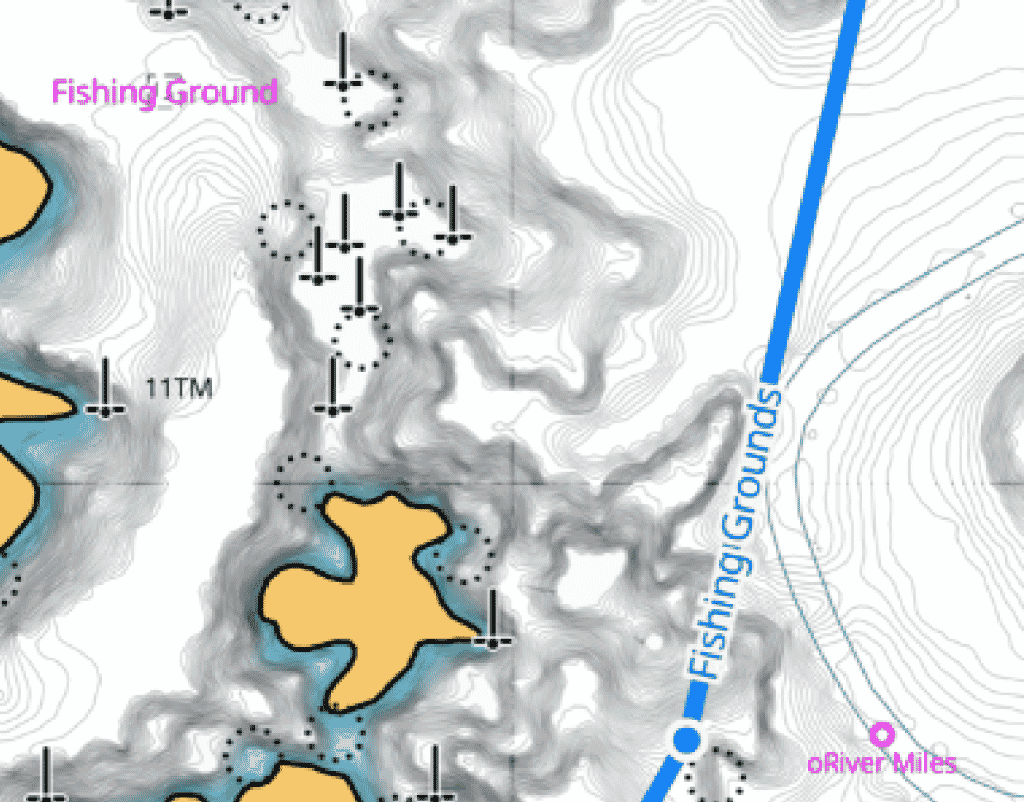
With C- MAP’s High resolution bathymetry, it helps the user identify shallows, drop-offs, ledges, holes or humps through contour lines accurate down to a 1-ft level of detail.
Autorouting
Long gone are the days of having to put each turn for your route. With Autorouting the user only has to add a starting point and their destination to allow the autorouting to work its magic and plan the trip for you.
Weather Along the Route
As all anglers know, having access to weather updates is an integral part of having a successful and safe day out on the water. With the integrated ‘weather along the route feature’ it will tell you exactly what to expect weather wise at each time that you reach those selected points.
C-MAP Traffic & AIS
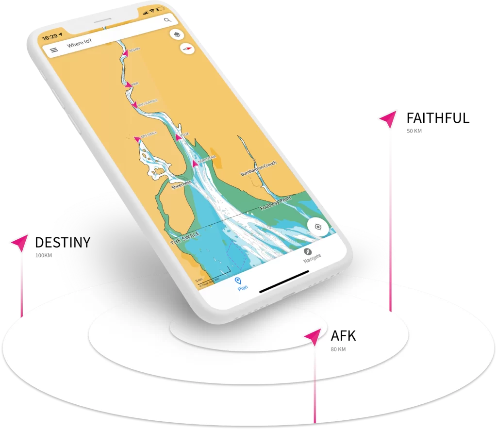
The C-MAP Traffic and AIS feature allows you to see all boats with Class A and B enabled AIS within a 100km radius. This feature allows you to view other vessel’s position, course and speed, helping you navigate through high traffic and low visibility on the water. This feature also allows the user to track other App users and friends.
Free VS Subscription
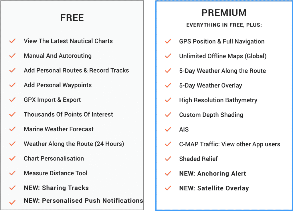
Premium users have the benefit of using the app offline, but there are plenty of useful features that come with the free version of the app.
Premium users can enjoy the benefit of a 5-day weather route report and all maps are unlimited, offline, and global. This can keep you informed on what’s going on without cell service.
Benefits of the C-MAP Navigation
From kayakers to commercial vessels, whether your intended use of the C-Map app is as a main source of navigation or simply a back up. You can rest assured that C-MAP’s extensive range of features will earn its spot as a navigational aid in any anglers fishing arsenal.
If you enjoyed this article, check out the rest of our Tech section!
You may also like:

